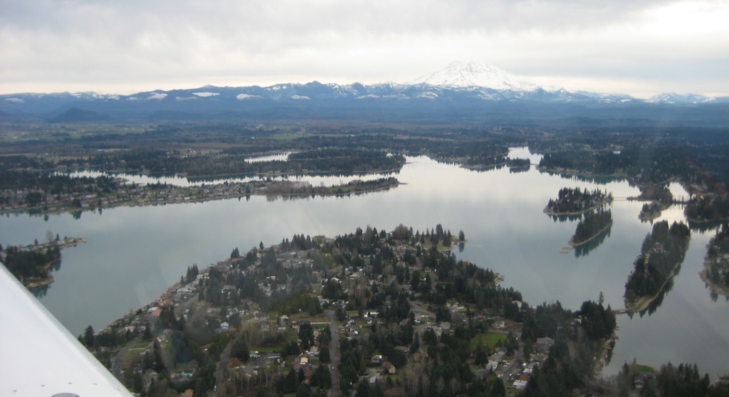
Lake Tapps is a man‑made reservoir in Pierce County where seasonal water level changes play a central role in shoreline stability, recreation, and infrastructure safety. Winter drawdown and water level management directly affect property owners around the lake, especially those responsible for docks, bulkheads, and near‑water structures.
How Lake Tapps Is Managed
Lake Tapps operates as a municipal water supply reservoir as well as a recreational lake, and a regional utility manages its levels under defined operating agreements. These agreements specify “full pool” recreational levels between roughly 541.5 and 543 feet in elevation from mid‑April through late September, after which the lake transitions into fall and winter operations.
During most years, managers begin actively lowering the reservoir starting around November 1, bringing the lake down to about 538–539 feet for the fall and winter period. This typical winter band is considered sufficient to protect the integrity of the Lake Tapps dikes and to allow for routine inspections and maintenance when wave and storm action are strongest.
Because the reservoir also supports downstream river systems, releases must balance shoreline safety, infrastructure needs, and regional water supply planning. Residents can review current operating information and level targets on the utility’s lake level page.
Why Winter Drawdown Matters for Lake Tapps Residents
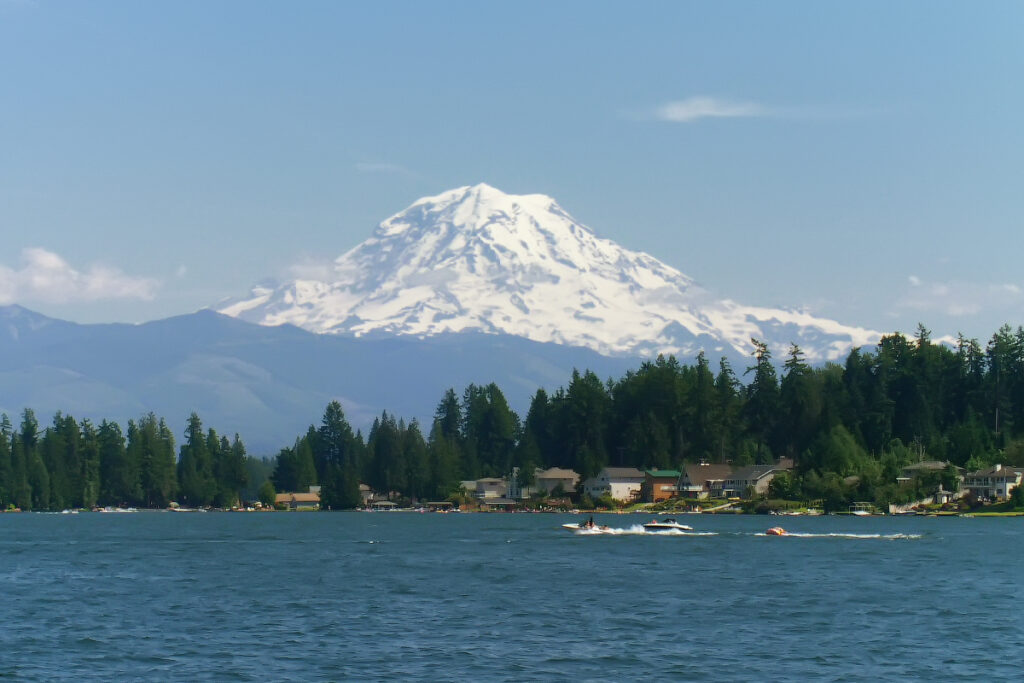
Winter in Lake Tapps brings cool temperatures, frequent rain, and occasional freezing conditions that can raise both erosion and flooding risks along the shoreline. Average annual precipitation is relatively high for western Washington, and the area records rain or other precipitation on many days each year, which makes water level management a critical tool for reducing winter storm impacts.
By lowering the lake below full summer pool, managers reduce the energy of waves reaching dikes and bulkheads during wind events, which helps limit scouring and structural damage. Drawdown also exposes portions of the shoreline and near‑shore structures, giving engineers and inspectors safer access to check riprap, dike faces, and outfalls.
For homeowners and property managers, the winter level directly affects dock stability, moorage safety, and access ramps, which is why they are advised to monitor official level updates each season. Local residents who want more detail about precipitation patterns and temperature ranges can review Lake Tapps climate data.
Typical Drawdown Pattern and Seasonal Timeline
Winter drawdown on Lake Tapps usually follows a predictable pattern, although year‑to‑year adjustments occur based on weather, inflows, and construction work. Full pool is reached in spring, often by late April, then maintained through the main recreation season before the gradual fall lowering begins.
Published plans describe a transition period in late October, followed by more active drawdown starting in early November down to about 538–539 feet for most of the cold season. In some years, levels may be reduced further when additional dike stability projects, utility work, or local government projects require greater exposure of structures.
Residents are encouraged to check the utility’s current lake level page throughout the year to track daily elevations and any special adjustments related to heavy storms or construction. For an overview of planned changes, notices, and seasonal updates, residents can read the utility’s Lake Tapps news updates.
Local Climate, Safety, and Regulatory Context
Lake Tapps has a cool, wet climate with winter temperatures often near or below freezing and an annual average temperature in the low‑50s Fahrenheit. These conditions create a combination of saturated soils, fluctuating reservoir levels, and occasional snow or ice, which all influence shoreline stability and dike performance.
Regional and federal agencies, including the U.S. Army Corps of Engineers, track flows and diversion data associated with the reservoir system to support flood risk management and downstream water rights. The managing utility references water rights, operating agreements, and local safety requirements in setting the winter drawdown band so that reservoir operations remain consistent with community agreements and regional planning goals. Residents can review current operating information and technical updates through the utility’s Lake Tapps information pages, which consolidate drawdown schedules, lake level graphs, and community notices in one place.
Because Lake Tapps is a constructed reservoir with extensive dike systems rather than a natural lake, dike monitoring and maintenance remain central to winter management decisions. Lower water levels decrease hydrostatic pressure on dikes during storm periods and help engineers identify seepage points, erosion features, or settlement areas that might require repair. This engineering focus shapes both the timing and depth of seasonal drawdown each year.
Practical Implications for Shoreline and Near‑Water Structures
Seasonal water level changes have direct implications for docks, bulkheads, boat lifts, and other structures along Lake Tapps. As the lake drops several feet from full pool to winter levels, flotation systems, pilings, and anchorage components experience different load patterns and exposure to air and freezing temperatures.
Property owners who rely on summer‑only access ramps or shallow‑water moorage may find that winter levels leave structures partially or fully out of the water, which can change how loads transfer to pilings or retaining walls. Drawdown also exposes footings, shoreline soils, and riprap that would normally be submerged, allowing residents and engineers to assess erosion, settlement, or ice damage and schedule repairs during lower‑risk periods.
Local residents can better understand current and future level plans by following the seasonal lake level updates posted by the regional water utility. According to federal and regional climate summaries, much of western Washington, including the Lake Tapps area, faces heavy winter precipitation and periodic extreme rain events associated with atmospheric rivers.
In an artificial reservoir system, winter drawdown provides additional capacity to buffer rapid inflows and manage downstream releases in coordination with broader river basin management. For communities around the reservoir, this combination of climate, infrastructure, and regulation makes winter water level management an essential feature of living near Lake Tapps.

_(2115903751).jpg)